

(File phoro)
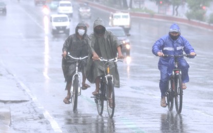
MANILA – The low pressure area (LPA) northeast of Hinatuan, Surigao del Sur will continue to bring rains over most areas in the country, the weather bureau said Friday.
The LPA embedded along the intertropical convergence zone (ITCZ) will cause scattered rain showers and thunderstorms over the Visayas, Mindanao, Mimaropa, the Bicol Region, and Quezon.
The tropical cyclone being monitored outside the Philippine Area of Responsibility (PAR) was last tracked 2,270 kilometers east of Mindanao.
"It is expected to enter PAR by Monday. However, we do not expect it to have a direct effect on the country," Ezra Bulquerin of the Philippine Atmospheric, Geophysical and Astronomical Services Administration (PAGASA) said.
For Friday's forecast, Cagayan Valley, Apayao, Kalinga, Ifugao, Mountain Province, and Aurora will continue to experience rains while isolated light rains will prevail over Ilocos Region, Abra and Benguet due to the northeasterly surface windflow.
Metro Manila and the rest of Luzon will have isolated rain showers caused by localized thunderstorms.
Moderate to strong winds and moderate to rough seas will prevail over Luzon and the Visayas.
Strong to gale force winds are likely over the seaboards of northern Luzon. PAGASA advised fishing boats and other small sea vessels not to venture into the sea, and larger sea vessels are alerted against big waves.
Over Mindanao, winds and seas will be moderate. (PNA)
Source: Business Diary Philippines


0 Comments