

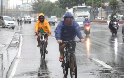
MANILA – The low pressure area (LPA) embedded along the intertropical convergence zone (ITCZ) will continue to bring rains over most areas in the country, the weather bureau said Thursday.
The LPA, last tracked 130 kilometers east of Hinatuan, Surigao del Sur still has a slim chance of developing into a tropical cyclone, according to Grace Castañeda of the Philippine Atmospheric, Geophysical and Astronomical Services Administration (PAGASA).
"However, we are still considering the possibility that it would develop into a tropical cyclone. Scattered rain showers and thunderstorms are forecast over the Visayas, Mindanao, Mimaropa, Bicol Region, and Quezon. Floods and landslides are likely, so residents of these areas are advised to coordinate with authorities on what to do as safety precautions," she said.
PAGASA has been monitoring an LPA that has developed into a tropical cyclone Wednesday. It was last located 2,435 kilometers east of Mindanao. "It is forecast to enter PAR on Monday. It may also cause rains over the Visayas as well as some parts of southern Luzon," Castañeda said.
Meanwhile, rains will prevail over Cagayan Valley, Apayao, Kalinga, Ifugao, Mountain Province, and Aurora, and isolated light rains over the Ilocos Region, and the provinces of Abra and Benguet due to the northeasterly surface windflow.
The rest of Luzon will have isolated rain showers caused by localized thunderstorms.
Moderate to strong winds and moderate to rough seas will continue to prevail over the entire archipelago.
Strong to gale force winds will prevail over the seaboards of northern Luzon. PAGASA advised fishing boats and other small sea vessels not to venture out to sea.
Larger sea vessels are likewise alerted against big waves. (PNA)
Source: Business Diary Philippines


0 Comments